Many people already have Google Maps on their phone, making that a convenient option for the driver, and fairly simple for the web designer to offer turn-by-turn driving instructions via your phone, starting from your current location when you’re in your car (or biking!).
However, this method comes with some limitations. Below, we have some tips for taking the Daffodil Tour with the aid of your phone. If they make this sound a bit too complicated, don’t worry: just download the printable turn-by-turn directions and tour map from any page on this site and use those. In fact, it’s a good idea to have the turn-by-turn directions with you even if you are using the Google Maps routes.
Tips for taking the Golden Roads Spring Daffodil Tour with Google Maps
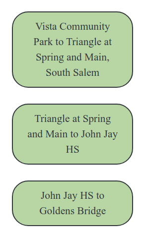
To the left is a picture of the route buttons for the Daffodil tour from Vista to Goldens Bridge. They are displayed on every page of this website. You’ll need to tap them one at a time to follow the entire route. On a mobile device, the buttons will be below the main content on the page. On a wider screen, they will be on the right-hand sidebar. There is also a set of buttons to take the tour from Goldens Bridge to Vista.
You can start the Daffodil tour in Vista or Goldens Bridge—whichever is closer to you, or whichever ends up where you want to end up. The turn-by-turn voiced routes are divided into three segments, which you can do singly, or in sequence, by tapping the route buttons on your phone. That will open the route in the Google Maps application on your phone. Leave the web browser open in the background on your phone while you’re following the route so you can return to it easily to start the next segment. To start the tour you’ve chosen, you may need to tap “Start” after you click the route button and Google Maps opens.
If you’re viewing this on a non-mobile device and are logged into Google, you can send a route to your phone by clicking its button. If you just want to view the full tour, use the “Spring Driving Tour” link in the menu above, instead, or use the link for the printable tour map on the right-hand sidebar.
When you arrive at a Daffodil display, Google Maps will say (if you have sound turned on) “You have arrived at your location.” It won’t tell you what that location is out loud, so you have to look at the screen to see where you’ve arrived. The route may disappear from the screen temporarily when you are at a stop. Click “Continue” to continue the route when you’re ready, and you’ll be back on the route. At the end of one route segment, return to the website and click on the button to start the next segment of the tour.
IMPORTANT: It’s best if you have another person in the car with you to act as navigator, so the driver’s attention can stay on the road until you are ready to pull over to admire the daffodils.
CAVEATS: Sometimes, Google Maps will insist on driving into a location (like Onatru Farm, or the Lewisboro Town Offices) if that location is put into the route. For this tour, you usually just need to slow down or pull over on the side of the road to enjoy the view. That’s why you’ll see “103 Elmwood Road” instead of the “Alice Poor Garden” and “Onatru Farm” for your stop. Using “Onatru Farm” would bring you into the parking lot, when the the roadside view is a wonderful view. If you have also printed out the turn-by-turn directions, you’ll know just where to look when you arrive.

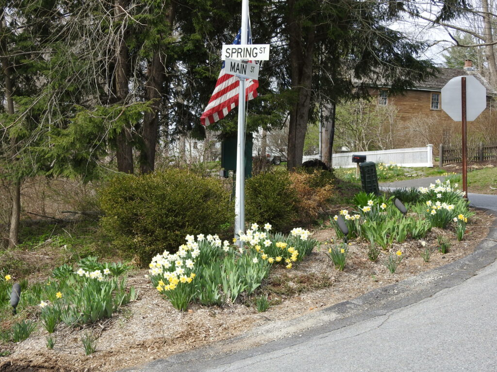
Regarding the “Flagpole Garden” at Spring Street and Main Street in South Salem: Google REALLY has a problem routing you through that hair-pin turn. These daffodils are in the triangle between Spring and Main. Note that this location is the end of one route segment and the beginning of another, so your navigator will need to click on the button for the next route segment here if you are continuing on the route. If you miss this sharp turn, you can always stop at the deli for a snack before getting back to the next segment of the route!
Sometimes, if you hit the wrong thing on your screen, it might seem like you’ve lost the tour in progress. Try re-centering the map with the icon that is like a bulls-eye, including one circle with four compass lines coming out of it, and you should be able to resume the tour from where you are.
You may also have problems if you hit a dead zone for cell phone data reception. It might help if you download the area maps for offline use ahead of time in Google Maps, but this is another case where it helps to have a navigator who can tell you how far you are from the next stop, when hopefully, you’ll be back in range.
Again, if this sounds too complicated, just download the printable map and the turn-by-turn instructions for your navigator to read out to you as you drive.
Another Google Maps Daffodil tour option:
The links below provide step-by-step, but NON-interactive directions. The voiced routes in the are limited to 10 “waypoints” (points of interest), but when we are building a non-voiced route that your navigator will step through manually, we can include the entire route.